Maximize
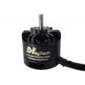
Ace Waypoint 900Mhz
- Remove this product from my favorite's list.
- Add this product to my list of favorites.
 Maximize
Shop with confidence:

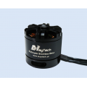
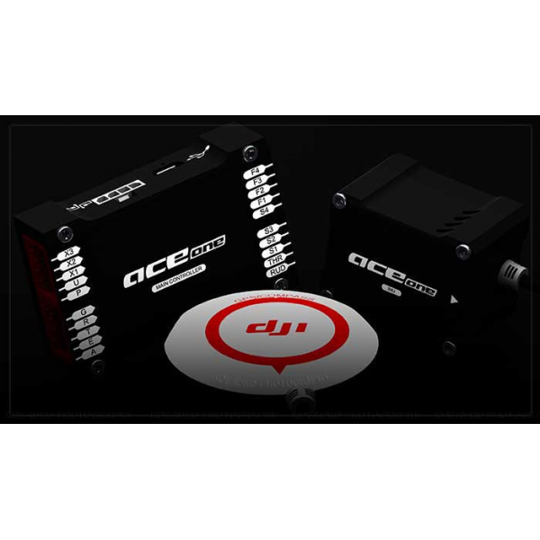
Ace Waypoint ground station system is built on an upgrade from Ace Ones DJI fourth generation helicopter autopilot products, and ground control software (GCS). It has all the features of Ace One, while providing the advanced reliability and flight stability core modules. Precise flight positioning, high mobility and ease of use, together with the aid of the advanced industry professional level ground station system, upgrades the unmanned helicopter system into a fully automated aerial work platform, with applications in specialized professions, including various industrial operations.


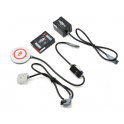
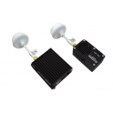
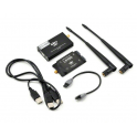
DJI offers 2.4Ghz and 900MHz datalink to achieve long-range two-way communication. The datalink maximum distance is up to 15km. The ground end also links with USB power supply that is convenient for outdoor use. The wireless module uses FHSS technology which is verified by FCC and CE certification, DJI datalink has many advantages such as: high data rate, stable performance, strong anti-interference capability, and long communication distance. The 2.4GHz datalinks power consumption is 550mw and 900MHz datalink 1.5W, which is big advantage for long-distance flight missions.


The entire ground control system combines GPS 6DOF inertial measurement unit, magnetometer, and pressure altimeter sensors to optimize robustness of algorithms and robotic control logics. Ground control system utilizes advanced GPS/INS proprietary algorithm technology in the entire design. Even in adverse conditions, high vibration and high demand environments, the helicopter maintains flight stability accurately to ensure mission success rate.
System design and use of high grade components enables fast GPS acquisition time. Compass calibration with 45° tolerance is easier and faster than previous models.


DJI Ground Station designed around intuitive Google 3D map offering GIS data. Pilot can operate and plan flight routes anywhere, use PC mouse to zoom in/out of 3D Maps which can be downloaded to PC and used elsewhere in offline mode.


In addition to the aircraft location, heading and altitude, our ground station also provides other flight data such as attitude, air speed, vertical speed, throttle and pitch percentage and servo voltage at all times.


Ground Station equipped with intelligent adaptive system. During abnormal signal loss , the system will adjust to environment to activate failsafe appropriately. The aircraft will implement and complete the default route mission automatically, even when datalink signal is lost.
When user is in manual mode, the aircraft will hover when RC signal lost. But after 10S, if the signal doesnt come back, the aircraft will find the take-off point precisely and return using the safest route and height . Then the aircraft will hover over the take-off point automatically. This function offers the intelligent security protection for users expensive aerial equipment. In addition, the user can always click the return button, the system will interrupt the current mission immediately to order to return the aircraft to back the take off point.

Operator can either use keyboard or joystick with ground station system to control the helicopter movements and attitude via DJI data link. Manual mode can be applied when out of radio (transmitter) signal range by using either keyboard or joystick for control. This provision/feature allows control when the radio (transmitter) stops working after the mission has started.

DJI emphasises the principle of user friendliness in all designs, the ground station offers 3D graphic interface, a breakthrough from traditional UAV system with ease of installation, less complexity and ease of operation in comparison to others in the market. DJI ground station control can save time, improve operation efficiency, ease mission planning supporting flexible and intelligent control for any mission.


Click on any point on a 3D map, the aircraft can achieve the coordinates point automatically, particularly useful when some routes cannot be set in advance. Flight altitude and flight speed can also be adjusted rapidly and accurately according to the change of data and waypoints when the user has to change the target and flight mission.

Beyond Visual Range (BVR) of Ground Stations System designed for high-end commercial and industrial automatic flight that requires a reliable long-range wireless communication device (Data Link) and ground station control system (GCS). The flight route, default action of photographs, and airdrop can be planned in advance on the ground station control software.

Attitude leveling stability optimization algorithm enhances control feel and flight path control in ATT Mode. Helicopter forward air speeds of up to 25 meters per second in GPS cruise mode ensure longest possible flight mission.


Waypoint controller advance development offers automatic take off and landing feature which can be applied using either by radio transmitter or ground station keyboard. Take off and landing (ascending and descending) speed is 0.2 to 0.5 meters per second.

Waypoints can be set to the number of destinations up to 200. They are the basic unit of composition routes tasked to meet the complex requirement of the routes operating. Users can carry out special settings, such as height, latitude and longitude, flight speed, the nose toward, the turning patterns and residence time etc. User can batch for all destinations, by setting once if required.

Ground Station provides 6 types of pre-set route templates which are default settings that can assist in completing a mission quickly, in a designated area with set height. The size of coordinates for the mission area, the number of waypoints in the region, the waypoint properties, etc. can be customized. Those templates can be especially applied for vertical photography, precise mapping, spraying agriculture and other industries.


There are 3 different fight routing planning modes: fixed-point turn mode, coordinated turn mode and adaptive coordinated turn mode.
Fixed-point Mode: Aircraft flies to the first fixed point accurately, stays at the fixed point and then flies to the next fixed point . The fixed points and the length of each stay also can be set in advance.
Coordinated turning mode: The route of aircraft is calculated with turning speed and turning angle. The helicopter would fly from one point to another point without stopping.
Adaptive coordinated turning mode: It is almost the same performance with Coordinated Turning mode. But the flight routine will be more accurately detailed with a planned flight routine in this mode.


Real time flight altitude data is vital in real time flight data collection. Correct Ace Waypoint altitude setting determines the success of the flight mission. There are two displays for height; normal height and elevated mode. In normal height mode, the system records the helicopter at 0 height reference point- above (+) value means above ground and (-) value means below ground. In elevated mode, the helicopter altitude is the same as elevation according to Google Map. Due to altitude, the sensor can be affected by weather condition, and an offset of altitude may be necessary. Please refer to manual for detail setup.


DJIs autopilot system provides two servo outputs to support custom servo feature. These two outputs can be used between the controller and or 3rd party devices. These outputs for example can be used for camera shutter operation, air-drop activation or other switching devices.


During a flight mission, task start, delay and repetitive time can be set. By setting the time period, repeat time, start delay and repeat time parameters; operator can customize these functions to a specific application.

During flight mission, operator can re-edit mission such as modifying flight routes, or waypoints to achieve a real-time adjustment to complete the objectives. Operator can also click Pause button to suspend the mission; aircraft will slow down and hover awaiting new assignment. When and if signal is lost, the system will intelligently pick the optimal route to return home automatically.

User also can customise main controllers F1 to F4 channel's output signal to achieve the extra device operation such as Servo, Gimbal and Camera controlling.

Relative coordinates Editor is an accurate drawing tool of regular geometric figures on a 3D Map. Operator can set an initial waypoint then next waypoint with angle and distance details. Ground control system will calculate the next waypoint coordinates accurately.

Photogrammetry tool can be used with DJI aerial photography waypoint system in producing professional and accurate mapping. Thus, simplifies flight mission; a "must have" package for the professional photographer.


Ground control system can simulate real flight environment, operator does not have to perform actual flight to complete mission in simulated mode. The simulation mode is good for training and mission test.

All routes/waypoint settings can be exported and saved from the controller to any computer (PC). The saved files can be imported for future use.


See Overview section for more videos.

| Supported Helicopter | Electric and fuel powered |
| Swash Support |
|
| Supported Servo Output |
|
| Recommended Transmitter |
|
| Recommended Power Supply | DC 4.8 ~ 8.4V (Not be exceed MAX operating voltage of servo motor) More than 4000 mAH capacity Discharge current more than 5C No separate servo power supply required |
| Operating Temperature | -20°C to +70°C |
| Power Consumption | MAX 5W (0.9A@5V, 0.7A@5.8V, 0.5A@7.4V, 0.4A@8V) |
| Built-In Memory | 4GB Flash Memory for flight information recording |
| Assistant Software System Requirement | Windows XP / Windows Vista / Windows 7 / Windows 8 |
| Hovering Accuracy(GPS Mode) |
|
| Suitable Wind Condition | < 8 m/s (17.7mph) |
| Forward / Backward Speed | ± 72 Km/h (44.74mph) |
| Left / Right Speed | ± 56.7 Km/h (35.77mph) |
| Acceleration Ascent / Descent | Adjustable via ACE ONE ASSISTANT software,can be limited by user precisely |
| Weight | <= 150g (The devices on helicopter) |
| Dimensions |
|
| Built In Functions |
|
| Packaging List |
|
| Language |
|
| Properties |
|
| Assignments |
|
| Mission Mode | Continuous / Start to End |
| Turning Mode | Stop and Turn / Bank Turn / Adaptive Bank Turn |
| Map Browser | Google Earth 3-D GIS |
| Safety Control |
|
| Flight Instruments |
|
| Electronic / Electromechanical | IMU |
| Airborne Equipment |
|
| Communication |
|
| Rotorcraft Control Modes |
|
| Pre-Flight Simulation | Virtual environment aid to help users get familiar with operations |
| Operating System Requirements |
|